
Introduction
Location has always played a vital role in agriculture. From understanding soil conditions and climate patterns to planning crop production and managing resources, knowing exactly where farms are located is essential for making informed decisions.
Yet many agricultural organizations still rely on estimates, handwritten records, or outdated maps that provide little insight into the actual distribution of farms. This lack of accurate location data limits productivity, weakens planning, and makes it difficult to deliver targeted agricultural services.
Modern GPS Farm Mapping Software is transforming the way farms are identified, monitored, and managed. By combining satellite positioning, digital maps, and cloud-based data management, organizations can build accurate farm records, improve agricultural planning, and create stronger, more transparent value chains.
AgroTrack Cloud integrates farm mapping technology with digital farmer profiles, crop monitoring, agricultural analytics, and traceability to help stakeholders make smarter, data-driven decisions.
What Is GPS Farm Mapping Software?
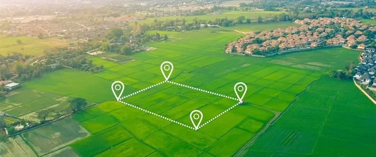
GPS Farm Mapping Software is a digital solution that uses Global Positioning System (GPS) technology to accurately capture farm locations, boundaries, and land characteristics.
Instead of relying on manual sketches or approximate coordinates, field officers can use smartphones or GPS-enabled devices to map farms with precision.
The software typically records:
- Farm boundaries
- GPS coordinates
- Farm size
- Land ownership or management details
- Crop information
- Production history
- Farm activities
- Photographs and supporting records
When integrated with a Digital Agriculture Platform, this information becomes part of a centralized agricultural database that supports planning, monitoring, and reporting.
Why Farm Mapping Matters in Modern Agriculture
Accurate farm mapping provides the foundation for effective agricultural planning.
Without reliable location data, organizations often struggle to answer important questions such as:
- Where are farmers located?
- How much land is under cultivation?
- Which crops are grown in each region?
- Which farms require advisory support?
- Where should agricultural inputs be distributed?
By using farm mapping technology, organizations gain a clear understanding of agricultural landscapes and production capacity.
This visibility enables better resource allocation and more effective program implementation.
Building Accurate Digital Farm Records
One of the greatest advantages of GPS mapping is the creation of verified digital farm records.
Each mapped farm can be linked to a digital farmer profile, creating a complete picture of both the farmer and the land they manage.
A digital farm record may include:
- GPS location
- Farm boundaries
- Acreage
- Crops cultivated
- Soil information
- Production history
- Harvest records
- Advisory history
- Input distribution records
Together, these records create a reliable source of agricultural information that can be updated season after season.
Supporting Smarter Agricultural Planning
Agricultural planning depends on accurate data.
When organizations know where farms are located and what they produce, they can make better decisions about investments, logistics, and service delivery.
GPS Farm Mapping Software helps improve:
Resource Allocation
Organizations can distribute seeds, fertilizers, and other agricultural inputs more efficiently based on verified farm locations and production needs.
Extension Services
Agronomists and extension officers can prioritize farm visits, deliver location-specific recommendations, and monitor progress more effectively.
Production Forecasting
Mapped farms combined with crop data enable more accurate estimates of expected production volumes.
Infrastructure Planning
Governments and development partners can identify areas that require roads, irrigation systems, storage facilities, or other agricultural infrastructure.
Enhancing Precision Agriculture
Precision agriculture relies on accurate spatial information.
With farm mapping technology, farmers and agribusinesses can make more precise decisions regarding land management and crop production.
GPS mapping supports:
- Variable input application
- Crop zoning
- Soil management
- Water management
- Yield optimization
When combined with satellite imagery and weather information, mapped farms become the foundation of a Precision Agriculture Platform.
This improves productivity while reducing waste and unnecessary costs.
Improving Agricultural Supply Chain Visibility
Location data also strengthens agricultural supply chains.
Buyers, exporters, processors, and certification bodies increasingly require accurate information about where products originate.
GPS mapping enables organizations to:
- Verify production locations
- Strengthen farm-to-fork traceability
- Support certification programs
- Improve sourcing transparency
- Build trust with international buyers
When integrated with Agriculture Traceability Software, GPS mapping creates complete visibility from farm to market.
Better Farmer Support Through Location Intelligence
Every farming region has unique characteristics.
Weather conditions, soil types, water availability, and pest pressures vary from one location to another.
GPS-based location data enables Digital Farmer Advisory Platforms to provide more relevant recommendations based on local conditions.
Farmers can receive:
- Weather alerts
- Crop-specific guidance
- Pest and disease notifications
- Fertilizer recommendations
- Seasonal planting advice
This personalized approach helps improve productivity and resilience.
Using Farm Mapping Data for Agricultural Analytics
Mapped farm data becomes even more valuable when combined with analytics.
An Agricultural Data Analytics Platform can generate insights such as:
- Regional crop distribution
- Farm density
- Land utilization
- Production capacity
- Yield forecasting
- Input demand
- Climate risk analysis
These insights help governments, cooperatives, agribusinesses, and development organizations make evidence-based decisions that improve agricultural outcomes.
The Role of GPS Mapping in Sustainable Agriculture
Sustainability initiatives require accurate environmental data.
GPS mapping helps organizations monitor:
- Land use changes
- Conservation practices
- Climate-smart agriculture initiatives
- Reforestation efforts
- Carbon and ESG reporting
By understanding where agricultural activities take place, organizations can better measure environmental impact and promote responsible farming practices.
Why AgroTrack Cloud Integrates GPS Farm Mapping
AgroTrack Cloud combines GPS Farm Mapping Software with a comprehensive Digital Agriculture Platform to provide a complete view of agricultural operations.
The platform enables organizations to:
- Register farmers digitally
- Create digital farmer profiles
- Map farms using GPS
- Monitor crop production
- Deliver digital advisory services
- Track agricultural supply chains
- Generate agricultural analytics
- Support data-driven decision-making
This integrated approach helps build transparent, efficient, and scalable agricultural value chains.
The Future of Farm Mapping Technology
As agriculture continues to evolve, farm mapping technology will become increasingly important.
Future innovations include:
- AI-powered land analysis
- Real-time satellite monitoring
- Drone-assisted farm mapping
- Automated boundary detection
- Climate risk modeling
- Predictive agricultural planning
Organizations that invest in GPS-based mapping today will be better prepared to manage agricultural risks, improve productivity, and meet the growing demand for sustainable food systems.
Ready to Digitize Your Farm Mapping Process?
Accurate location data is the foundation of smarter agriculture.
AgroTrack Cloud provides advanced GPS Farm Mapping Software that helps cooperatives, agribusinesses, governments, NGOs, exporters, and financial institutions build reliable digital farm records and improve agricultural planning.
Whether you’re mapping hundreds of farms or managing thousands of farmers across multiple regions, AgroTrack Cloud gives you the tools to make informed decisions backed by trusted data.
Request a Demo Today and discover how GPS farm mapping can transform your agricultural operations.
Visit: www.agrotrackcloud.com