
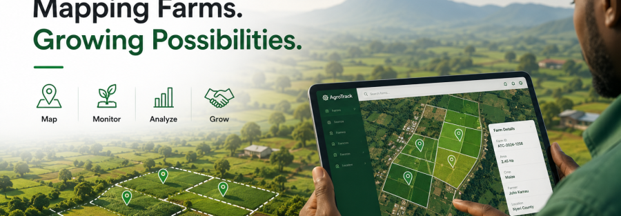
Many agricultural organizations know who their farmers are—but far fewer know exactly where their farms are.
Without accurate location data, it becomes difficult to plan field activities, estimate production capacity, monitor crop performance, distribute inputs efficiently, or build transparent agricultural supply chains.
As agribusinesses, cooperatives, governments, and development organizations expand their operations, understanding the geographical distribution of farms is becoming a strategic advantage rather than a luxury.
This is where GPS Farm Mapping Software plays a vital role.
AgroTrack Cloud provides an integrated Digital Agriculture Platform that enables organizations to digitally map farms, connect them to Digital Farmer Profiles, and use location intelligence to improve agricultural planning and decision-making.
What Is GPS Farm Mapping Software?
GPS Farm Mapping Software is a digital solution that captures the exact geographical location of farms using GPS technology.
Instead of relying on descriptive directions or manual sketches, organizations can accurately record farm boundaries and coordinates while linking them to farmer records.
With AgroTrack Cloud, every mapped farm becomes part of a connected digital ecosystem that includes:
- Digital Farmer Profiles
- Farmer Registration System
- Crop Information
- Production Records
- Input Distribution
- Crop Monitoring
- Agricultural Traceability
- Agricultural Data Analytics
This creates a complete picture of farming operations across an organization.
Better Planning Starts With Better Maps
Agricultural planning depends on knowing where production is taking place.
Without accurate farm mapping, organizations may struggle to answer important questions such as:
- Which regions have the highest production?
- Where are our farmers located?
- How far are farms from collection centers?
- Which areas require more extension services?
- Where should inputs be distributed first?
- Which farms are participating in our programs?
With AgroTrack Cloud’s GPS Farm Mapping Software, these questions become easier to answer through real-time location data and interactive digital maps.
Strengthen Farmer Management
Farm mapping becomes even more powerful when connected to a Farmer Management System.
AgroTrack Cloud links every mapped farm to a Digital Farmer Profile, allowing organizations to manage:
- Farmer identity
- Farm ownership
- Farm size
- Crops grown
- Production history
- Cooperative membership
- Advisory visits
- Harvest records
This creates a centralized Farmer Database Management system that supports better operational planning.
Improve Crop Monitoring
Knowing where crops are planted helps organizations monitor agricultural activities more effectively.
By combining GPS farm locations with crop information, AgroTrack Cloud enables organizations to:
- Track crop distribution
- Monitor seasonal production
- Plan field visits
- Support digital extension services
- Improve production forecasting
Location-based insights help agronomists and field officers provide more targeted support to farmers.
Enhance Agricultural Traceability
Traceability begins at the farm.
When farms are digitally mapped, organizations can connect agricultural products to verified production locations.
AgroTrack Cloud integrates GPS mapping with its Agriculture Traceability Software, allowing organizations to connect:
Farmer → Farm → Crop → Harvest → Batch → Market
This strengthens transparency across the agricultural value chain and helps build confidence with buyers, exporters, processors, and consumers.
Make Smarter Business Decisions
Location intelligence is more than a map—it is valuable business data.
Using AgroTrack Cloud’s Agricultural Data Analytics Platform, organizations can analyze:
- Farmer distribution
- Farm density
- Regional production
- Crop trends
- Supply availability
- Input coverage
- Program performance
These insights support better planning, budgeting, and decision-making.
Why Choose AgroTrack Cloud?
AgroTrack Cloud goes beyond simple farm mapping.
Our platform combines:
- GPS Farm Mapping Software
- Farmer Management System
- Digital Farmer Profiles
- Crop Monitoring Platform
- Digital Farmer Advisory Platform
- Input Distribution Management
- Agriculture Traceability Software
- Agricultural Marketplace Platform
- Agricultural Data Analytics
Everything works together in one secure cloud platform designed for modern agriculture.
Transform Your Agricultural Operations
Location data is becoming one of the most valuable assets in agriculture.
Organizations that understand where their farmers and farms are located can make better decisions, improve operational efficiency, strengthen traceability, and create more resilient agricultural value chains.
AgroTrack Cloud helps organizations turn farm locations into actionable agricultural intelligence.
Ready to digitize your farm mapping and farmer management?
Request a personalized AgroTrack Cloud demo today.
🌐 www.agrotrackcloud.com
📧 info@agrotrackcloud.com
📱 +254 790 550079 | +254 728 107303 | +254 724 465599